
This innovative project aims at the development of a Drone-Based Environmental Monitoring and Disaster Management System. This system aims to leverage advanced drone technology for real-time environmental monitoring, natural disaster assessment, and emergency response coordination in support of local Institutions. The object is to create a comprehensive system that uses drones equipped with advanced sensors and imaging technology to monitor environmental health, predict natural disasters, and aid in disaster response efforts.
Using AI and machine learning algorithms, the system will analyze data collected by drones to predict natural disasters like floods, forest fires, and landslides with greater accuracy. Post-disaster, drones will quickly assess damage to direct emergency responses efficiently.
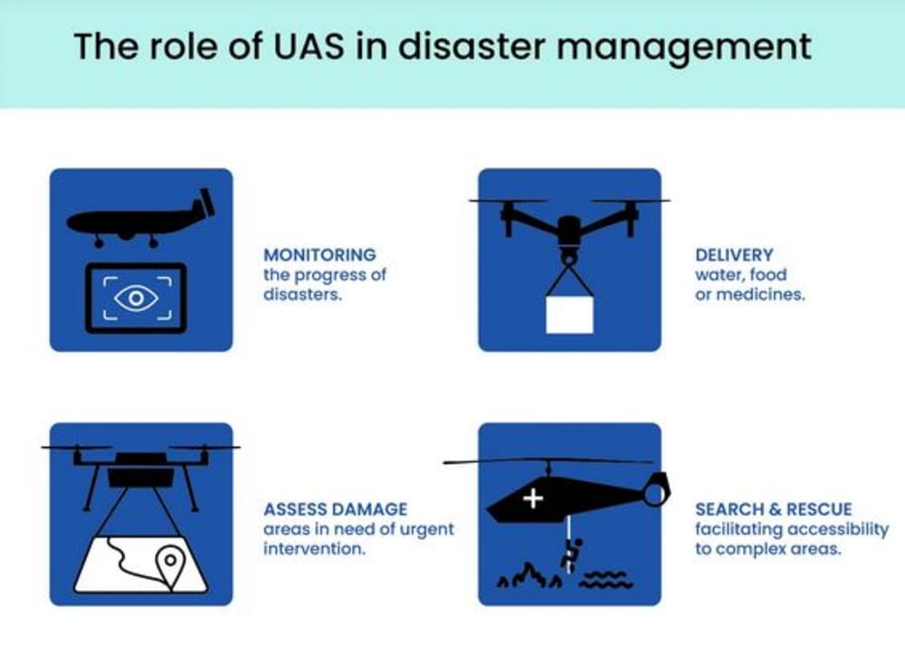
In the event of a disaster, drones can be deployed to deliver emergency supplies, serve as temporary communication hubs, and provide real-time visual feeds to rescue teams to coordinate efforts more effectively.
The Technology and Innovation involved:
- AI and Machine Learning: For predictive analytics, processing environmental data to forecast potential disasters, and analyzing damage post-disaster.
- Advanced Imaging Technologies: Including thermal imaging and multi-spectral sensors to monitor environmental health and assess disaster impact.
- Autonomous Flight Capabilities: Drones will have advanced navigation systems to fly in challenging conditions and cover large areas without direct human control.
The implementation phase will consider partnering with international organizations and governments to deploy the system focusing on areas most vulnerable to environmental issues and natural disasters.
As per the impact, an early detection and accurate predictions of natural disasters can save lives and reduce economic losses. Real-time monitoring allows for timely intervention to protect ecosystems. Rapid, informed response efforts can significantly reduce the impact of disasters on communities.
The need for a Drone-Based Environmental Monitoring and Disaster Management System arises from several critical factors that impact both environmental conservation and disaster response efforts.
Real-Time Data Collection and Monitoring:
Drones equipped with advanced sensors can cover large areas quickly, providing real-time data on environmental parameters such as air quality, water quality, vegetation health, and wildlife population dynamics. This real-time monitoring is crucial for early detection of environmental issues and proactive disaster preparedness.
Precision and Accuracy:
Drones equipped with specialized sensors like multi-spectral cameras and thermal imaging can capture data with high precision and accuracy. This level of detail allows for detailed environmental mapping, identification of subtle changes in ecosystems, and precise assessment of disaster impacts.
Rapid Response and Assessment:
Drones can be deployed quickly to assess disaster-affected areas, identify hazards such as blocked roads or collapsed buildings, and provide real-time situational awareness to emergency response teams, enabling more efficient resource allocation and coordination of rescue and relief operations.
Enhanced Safety and Accessibility:
Deploying drones for environmental monitoring and disaster response reduces the risks associated with sending personnel into hazardous or inaccessible areas. Drones can access rugged terrain, hazardous zones, and disaster-affected areas without endangering human lives.
Technological Innovation and Integration:
Integrating drones with advanced technologies such as artificial intelligence, machine learning, and geographic information systems enhances the capabilities of environmental monitoring and disaster management systems for comprehensive decision-making.
Like this entry?
-
About the Entrant
- Name:Luigi Liguori
- Type of entry:individual
- Patent status:none