


This work details the design and development of a medium endurance unmanned aerial vehicle designed for aerial surveillance, surveys and cartography. Defense Housing Authority (DHA) City is Pakistan’s largest land development project and the first to implement the “smart city” concept. For a holistic smart solution, the suburban city will need an eye in the sky. Moreover, due to hilly and irregular terrain, precise cartographical data is required.
Fixed unmanned aerial vehicles have recently found both civilian and military applications, with overwhelming focus on the former. A particularly high need has developed for UAVs with continuous area coverage capabilities. There are several industries in which these vehicles would be useful; however, few options are available for the customer at an affordable price.
In recent years, there has been a realization among aircraft manufacturers and the public of the enormous potential that exists in a civilian UAV market. One such industry is the land development companies and agencies. DHA City Project in Karachi is a “smart city” being customized to highly urbanized modern living. A requirement for such a grand scheme is high resolution mapping of the land, which due to its expanse can only be done efficiently with a mechanical engine powered fixed wing UAV. This work described the computer aided design and optimization of this solution. Baseline design is achieved through first principles methods and the design is further refined based on extensive simulations and genetic algorithms.
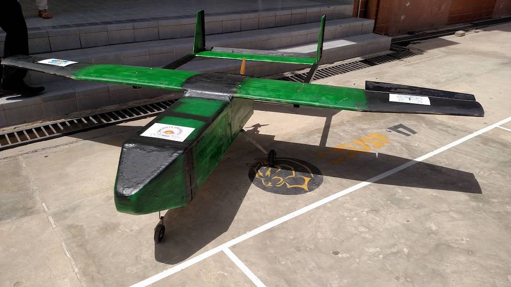
DHA Uraan UAV is a tailor-made solution, which features medium endurance and 12 lb of payload. It will be able to take-off from small runways as short as 1000 feet. This work details the design philosophy and optimization of parameters, based on customer requirements. It also describes the simulation based design optimization tool developed in-house for this purpose, which is used to produce an optimum configuration of 10ft wing span equipped with a 4.1 hp engine and twin boom mounted tails. The tool also automatically tunes the autopilot and builds nonlinear simulator for the aircraft.
Video
Like this entry?
-
About the Entrant
- Name:Adam Asif
- Type of entry:teamTeam members:Adam Asif Hiba Ahsraf Mohsin Ahmed Shoaib Ahmed Shujah Rizvi Dr. Bilal Siddiqui
- Software used for this entry:MATLAB, SolidWorks
- Patent status:none