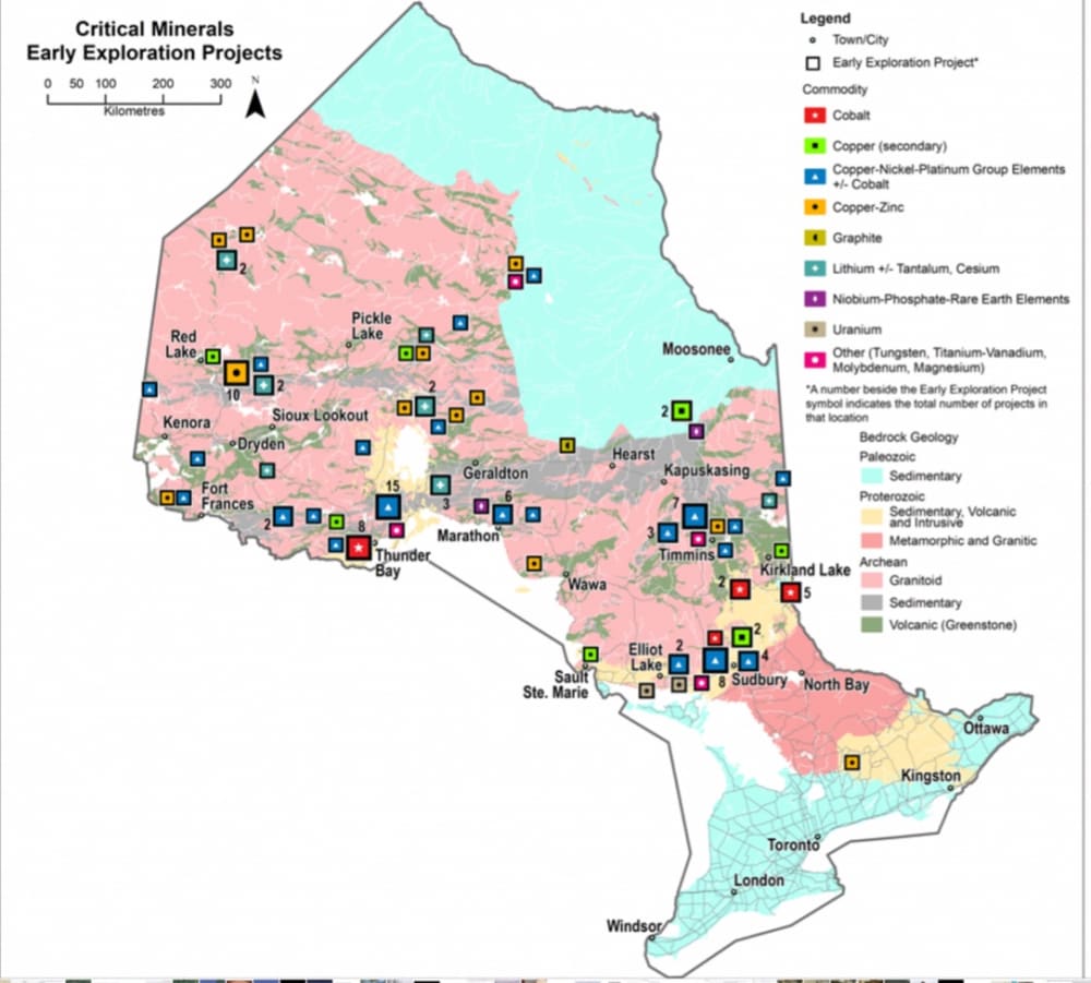


The “discovery by chance” of the Victor diamond mine location by a geology student during a fishing trip in the 1980s and subsequent research showing the “emptiness ” of the James Bay Wetlands suggests this entry promoting Air Cushion Technology to explore at ground level the potential of these Wetlands where Critical Minerals are concerned in or near the Ring of Fire in Northern Ontario. The map in the sidebar shows the Wetlands bordering James Bay.
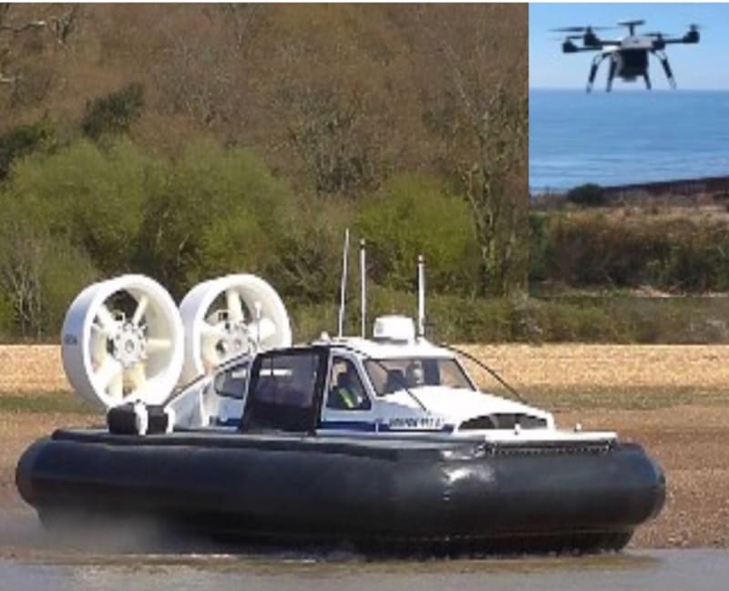
There are canoe routes throughout Northern Ontario which would be utilized to begin with as a known baseline and the other unmapped waterways would be explored and mapped by a Hovercraft/Drone/LIDAR combination (sidebar middle) emphasizing areas of interest as overlays on existing aerial surveys.
The costs for this exercise would be 1/10th to 1/15th the cost of an aerial survey with much more detail and 3D capabilities together with a benign environmental effect because of the Hovercraft low footprint pressure.
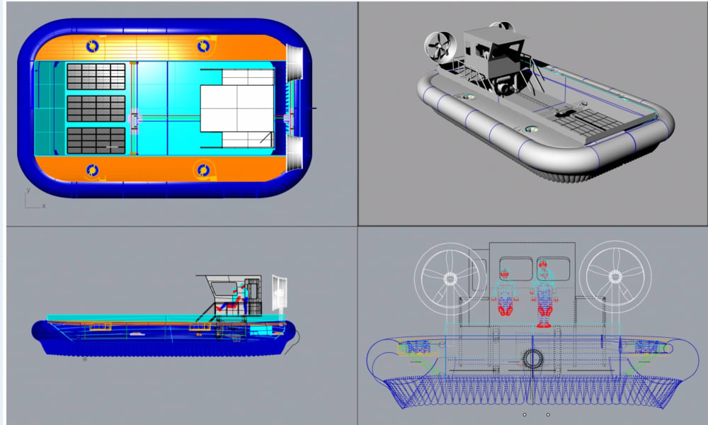
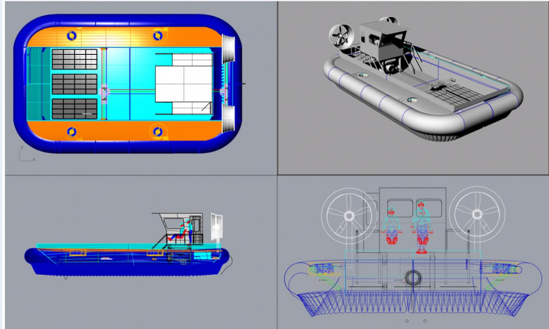
An 995ED hovercraft could be the pilot vehicle for this, but a 4tonne Air Cushion Landing Craft ( lower sidebar) configuration recently proposed for Ship to Shore early winter freeze up and Spring thaw use would be more appropriate for exploring the larger creeks and rivers since it could be rigged as a mobile laboratory and living quarters capable of on site evaluation of material samples.
Since Hovercraft are all seasons machines a comprehensive overview of the “unknowns “ without environmental impact is possible.
Hovercraft would work in parallel with existing conventional machines wherever required because of their flexibility.
The Victor Diamond Location in the middle of the Wetlands close to the Attawapiskat River was the most prolific of 16-18 kimberlite locations at that location and was only discovered because of a chance observation by a geology student during a fishing trip. Since the Ring of Fire Mining Area is just west of the diamond mine and 14 of the 18 Critical Minerals are in Northern Ontario but with accessibility issues, the use of hovercraft to access, explore, survey and map the potential of the sensitive Wetlands is the most logical choice since it is essentially amphibian country.
Together with LIDAR dedicated drones in conjunction with the hovercraft a comprehensive mapping and surface database as overlays on existing aerial surveys would be provided and since the costs would be much lower than conventional surveys with greater detail, planning for access requirements would have a much higher confidence level.
Roads to access the area have been estimated to be as much as $850,000,000 with no guarantee with regards to the drainage integrity of the Wetlands, which it is vital to maintain.
Where the effects of climate change are involved the use of hovercraft as benign vehicles with their very low footprint pressure evaluating the means of access to Northern Ontario’s Wetlands is less objectionable than any other considerations at this point in time and would be met with less opposition where sensitive environmental issues are concerned.
Like this entry?
-
About the Entrant
- Name:John Mitchell
- Type of entry:individual
- Software used for this entry:Rhinoceros
- Patent status:none