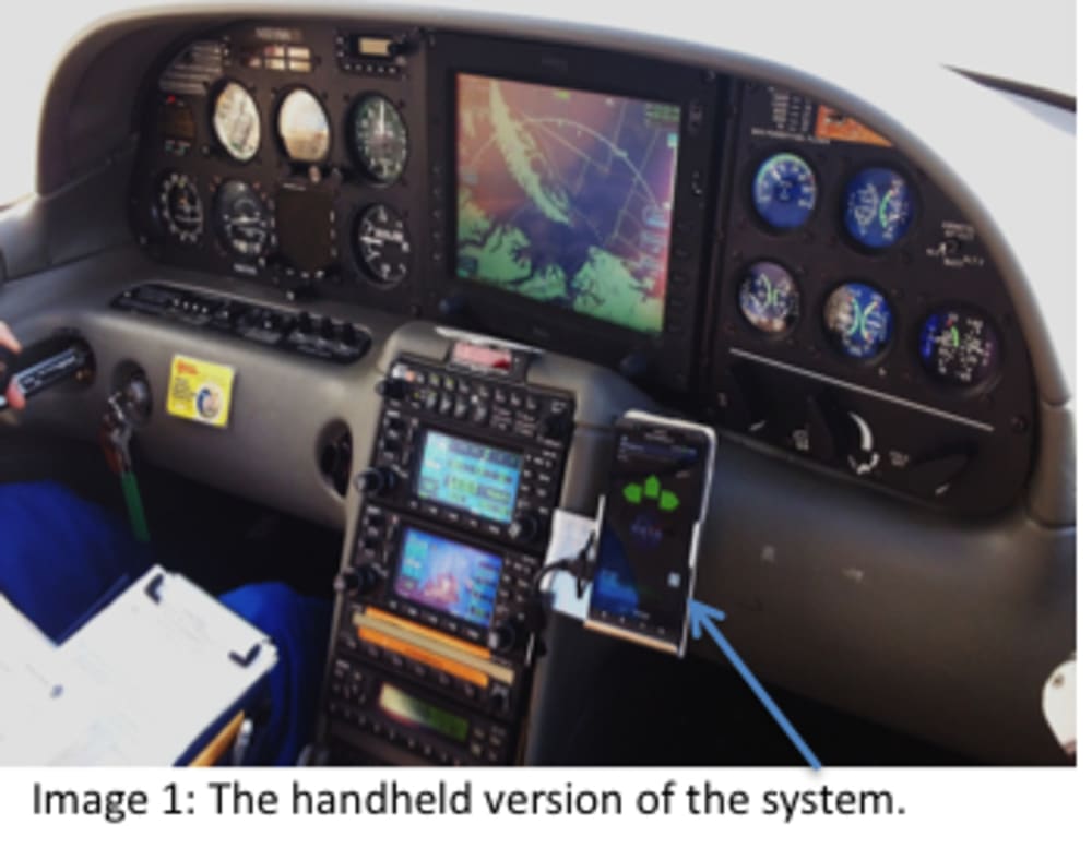


NASA's Armstrong Flight Research Center (AFRC) has developed a dramatically improved system for aircraft ground collision avoidance, which could prevent ~100 deaths each year in the U.S. alone. This advanced warning system offers critical features that have been packaged into an app for mobile devices to be used by pilots in any general aviation aircraft cockpit. This lifesaving safety tool also can be used in helicopters, fighter aircraft, and even unmanned aerial vehicles (UAVs).
PROBLEM: Controlled flight into terrain (CFIT) occurs when distracted or incapacitated pilots fly a fully functioning aircraft into the ground. More than 5,600 CFIT-related deaths occurred in the U.S. 2000-2009 (i.e., 17% of general aviation fatalities). The CFIT warning systems available to large commercial air carriers are not appropriate for fighter aircraft and are too expensive for general aviation.
BENEFITS: AFRC’s technology offers important benefits:
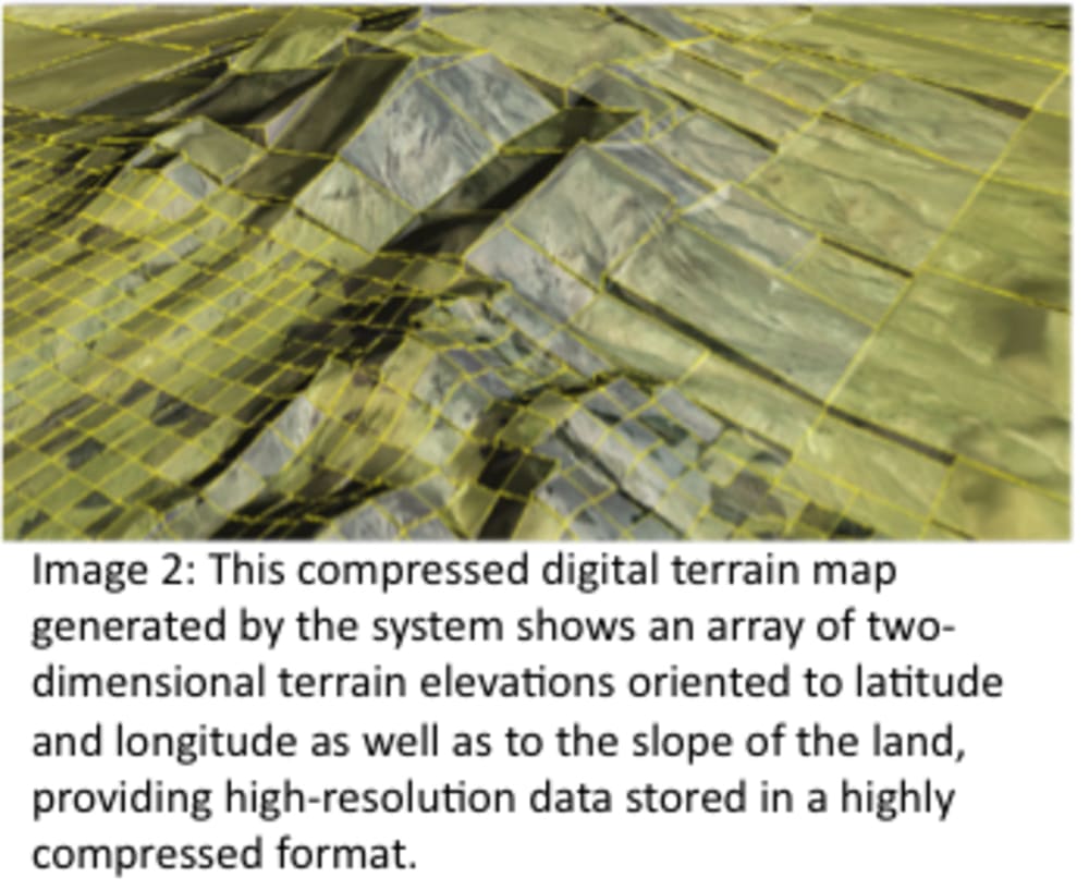
--High-fidelity terrain mapping: Enables the use of terrain maps with fidelity that is 2 to 3 orders of magnitude better than existing systems
--Ultra-high compression ratio (5000:1): Enables loading of complete world terrain in limited memories on mobile devices
--Nuisance-free warnings: Ensures alarms are triggered only for an impending collision, reducing false alarms that may cause pilots to ignore the system
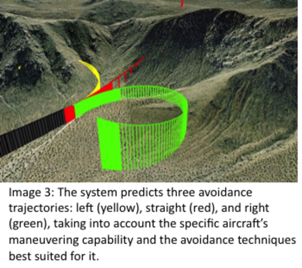
--Multidirectional maneuvers: Recommends multidirectional turns, making it appropriate for general aviation aircraft and UAVs
--Flexible platforms: Incorporates the aircraft’s specific maneuvering performance
--Proven technology: Evolved from the system deployed on the U.S. Air Force’s F-16 fleet, and has had testing completed on UAVs and a Cirrus SR22.
HOW IT WORKS: As the airplane approaches the ground, the system determines how much time remains before impact, guiding the pilot through climbing maneuvers to the left, straight, or right to avoid a crash. In the app version, the technology’s data, programs, and functions reside on the mobile device, eliminating any connectivity requirements. It also can be used on aircraft without an onboard pilot, as demonstrated by the smartphone-based system successfully tested on a NASA UAV.
A key aspect of the system is its patented handling of the digital terrain maps (DTMs). Its novel algorithms can compress extensive DTMs at the highly efficient ratio of 5,000:1 (compared to the prior art’s 4:1 ratio) and then dynamically decompress and render a continually updated local map around the moving aircraft in real time.
POTENTIAL MARKET, MANUFACTURING, COST: The market for this type of technology is predicted to be at least $55 million, or possibly higher given this technology’s ability to be easily used in any civilian or military aircraft, as well as with drones/UAVs. There are various options for the distribution of this technology as a product. For example, it could be an app for tablets or other handheld/mobile devices that pilots bring with them into the cockpit. The system also can be incorporated into electronic flight bags (EFBs) and/or aircraft avionics systems. Depending on the configuration, it is likely this technology could be made available for less than $100--well below the $6,000 price tag for equipment to prevent CFIT currently available.
More information: http://www.nasa.gov/offices/ipp/centers/dfrc/technology/DRC-012-033-collision-avoidance.html
Video
-
Awards
-
 2015 Aerospace & Defense Honorable Mention
 -
 2015 Top 100 Entries
Like this entry?
-
About the Entrant
- Name:Mark Skoog
- Type of entry:teamTeam members:Mark Skoog
Loyd Hook
Kevin Prosser
Shaun McWherter
Jamie Willhite - Patent status:pending