


An idea of embedding RFID tags on tactile paving as indoor positioning system to tell current location, direction and distance to destination through mobile app for visually impaired is proposed.
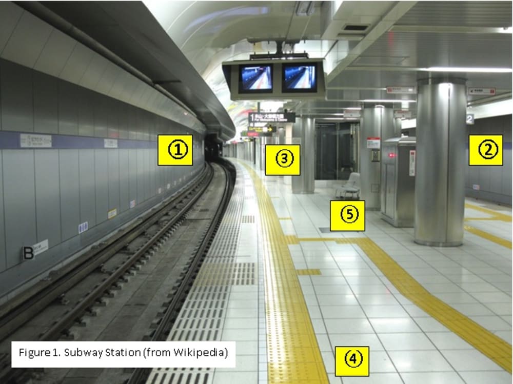
Tactile paving, a footpath with distinctive surface pattern, assists visually impaired people to walk and stop safely. Yet, it doesn’t tell which direction the path goes. For example, let assume Figure 1 is Manhattan Subway Station. Which side is a stop for a train to Brooklyn (? or ?)? Which direction (? or ?) should follow to go to the Exit to Broadway? Where path ? goes?
To solve the problem, RFID Tactile Paving System is proposed. The system consists of RFID tags in the tactile paving, RFID reader, and mobile app. The app reads RFID tags in the tactile paving through RFID reader and tells current location, direction and distance to destination to user through Bluetooth earphone.
RFID tags are cheap (10c per tag), robust, and easily embeddable in tactile paving (Radio signal penetrates through plastic paint). Attaching an RFID tag on tactile paving every two or three feet will suit the purpose.
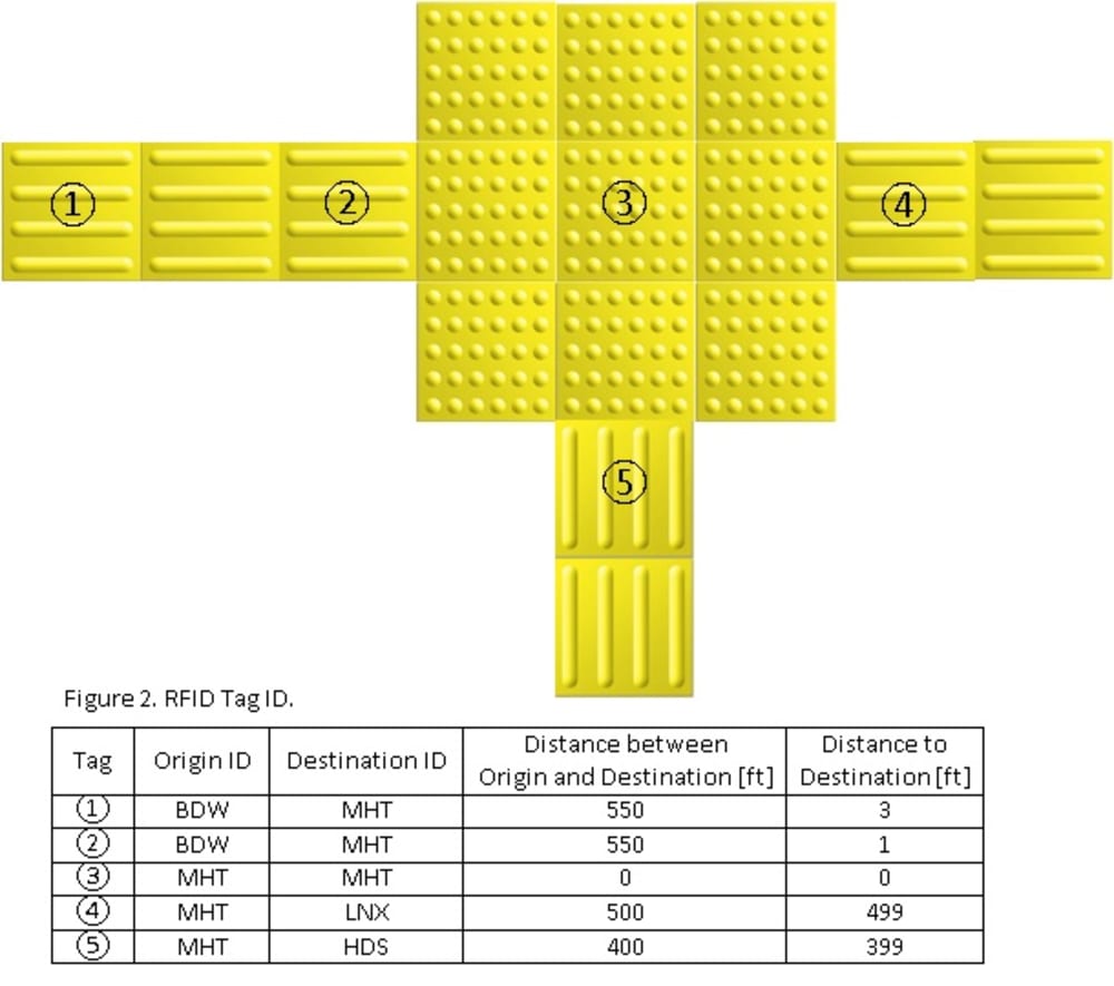
The data in an RFID tag contains Origin ID, Destination ID, optional Distance between Origin Point and Destination Point, and Distance to Destination Point as shown in Figure 2. The encoding method is similar to the numbering of Exit Numbers of Expressways. Origin ID and Destination ID can be Exit ID and/or Subway Station ID. With the RFID tag data, the mobile app tells current position, destinations of the forward path and the reverse path, and the distance to destination.
If user meets a branched path in the middle of a path (as a branch ? in between the path of ? and ? in Figure 1), the app also tells destination and the distance of the branched path.
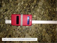
Users can read an RFID tag through a reader (or a smart phone with RFID reader) attached to a cane. As shown in Figure 3, the developed mobile app of a smart phone attached on a cane reads the RFID tag embedded under a road block and tells current location, destination, and distance to destination through a Bluetooth earphone successfully.
The proposed method tells current location similar to GPS but can be used inside building or underground. There are similar in-building location technologies using iBeacon or Wi-Fi hotspot. But the technologies are expensive and need continuous maintenance such as internet setup and replacing batteries. RFID tags are cheap, small, robust, and don’t require maintenance.
The proposed idea can be used for not only visually impaired people but for anyone with smart phone with RFID reader to find current location and direction in subways, airports, and buildings, such as a shopping mall or hospital. Similar to the market of tactile paving, the demand of RFID Tactile Paving System will be increased with the increasing demand of social service infrastructure.
Like this entry?
-
About the Entrant
- Name:Wonoh Kim
- Type of entry:individual
- Software used for this entry:COMSOL for RFID Range Optimization
- Patent status:none