


Every day, many of us notice special yellow tactile paving on roads here and there, special roads for people with eyesight disabilities, for the purpose of easier navigation. For years, there have been some attempts to somehow create a better navigational system. All the ideas I’ve seen (such as special mobile apps, for example) do not seem very effective to me.
So I decided to develop a system that would be precise and as simple as possible at the same time. First of all, if we look at most blind people at the street – we’ll notice that most of them use so-called “white canes” while walking. Since they already have a cane used for navigation, I decided to make it the central element of my system as well.
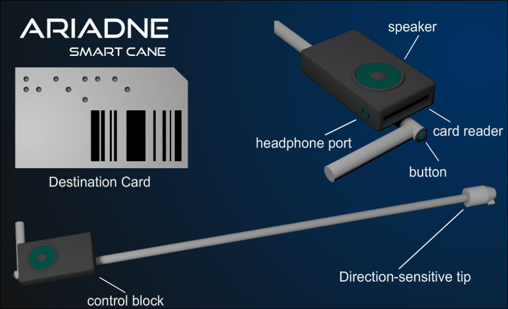
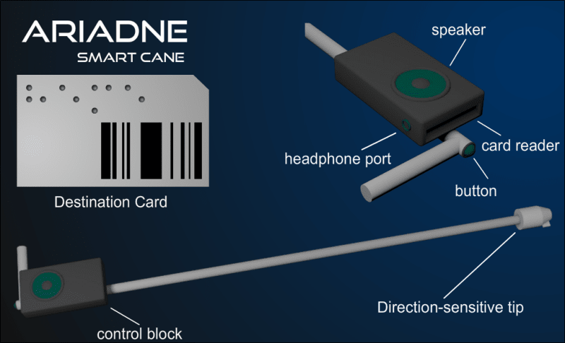
The system contains of a “smart” cane with a built-in card reader and a connector on the tip.
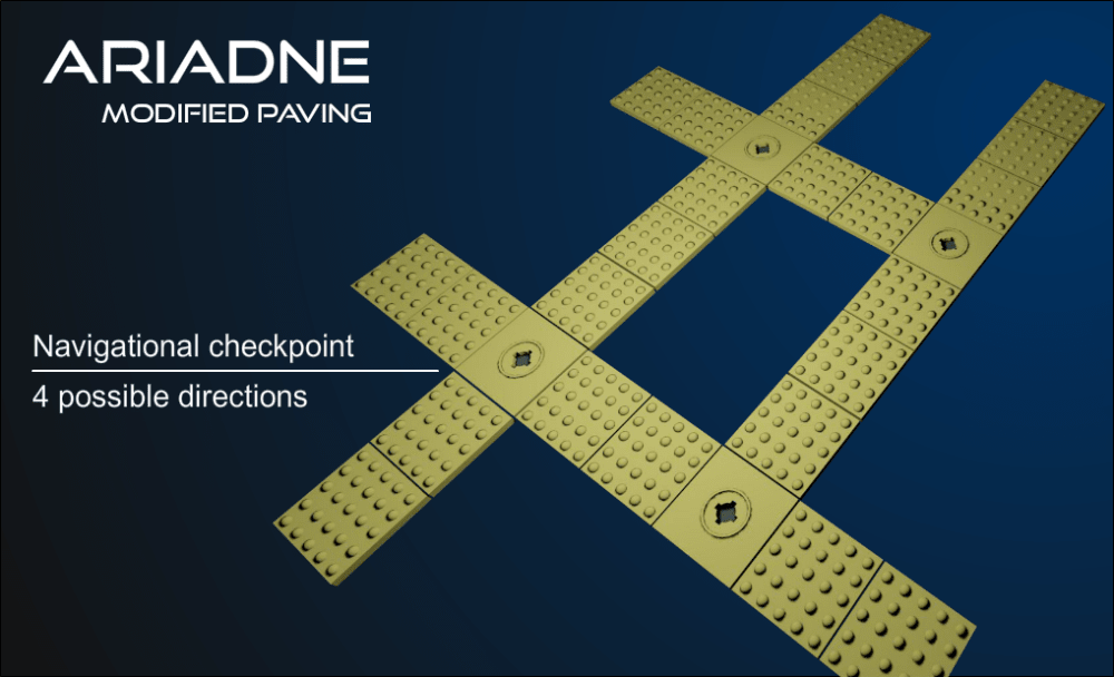
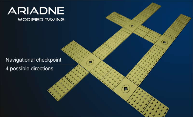
Tactile paving gets slightly modified, with addition of “checkpoints” at crossings and possible objects of interest, to which the cane can be connected. Each checkpoint has its number in the common network, which the cane can read when connected. Each checkpoint’s connector is protected from rain and dirt.
User has a set of cards for different destination points, such as home, shops, hospitals, schools etc. Each card has a Braille label explaining the destination point and a barcode of the destination checkpoint. To use the navigational system, user needs to perform following steps:
1. Insert the card with the desired destination point into the card reader.
2. Wait until the cane processor determines the shortest route to the destination point.
3. Connect the cane to the nearest checkpoint.
4. Follow instructions given out with voice system.
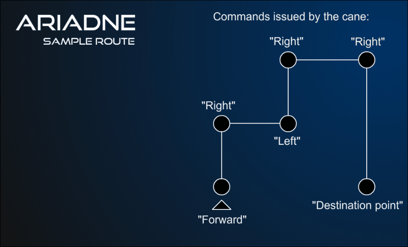
When user has a card in the cane and connects said cane to the checkpoint, the cane checks the number of the checkpoint it’s connected to, as well as the direction the user’s facing at the moment. Based on this data, the cane gives out instructions. It can tell user to move forward to the next checkpoint, turn left, right or around. After that, it tells the user the number of remaining checkpoints and remaining distance. If the system is integrated into the public transport system, it could also tell which bus or train the user should board and how many stops he/she should go. Since there are many mobile apps that provide real-time timetable for public transport, such integration seems absolutely possible and provides numerous advantages.
Advantages:
1. Precise determination of user’s location, since location of checkpoint is predetermined and well-known, so there’s no need to worry about errors, unlike GPS which would have an error too large to be used in this case.
2. Checkpoints do not need any independent power supply. They are powered by the cane through the connector. All route calculations are done by the cane itself.
3. The whole system’s structure is very simple and would be easy and cheap in production.
Like this entry?
-
About the Entrant
- Name:Aliaksei Khomchanka
- Type of entry:individual
- Software used for this entry:3ds MAX
- Patent status:none