


Search & Rescue (SAR) operations, in particular for victims lost in forests, is one of the challenging tasks faced by the Fire & Rescue Department Malaysia (JBPM). Based on JBPM’s current abilities, the modus operandi of JBPM’s SAR teams is based only on paper maps and compasses for navigation, while communications depend on walkie talkie, which only have an effective range of 300 m in forest environments. During SAR operations, the difficulties faced include locating victims and coordinating movement of the SAR team members. Furthermore, due to inefficient communications, SAR operations tend to be time consuming, which reduces the chances of safely rescuing the victims.
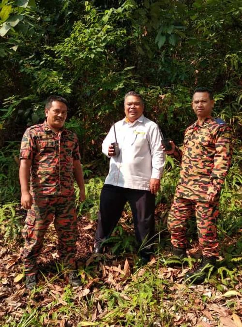
To this end, the Science & Technology Research Institute for Defence (STRIDE) in collaboration with the Kuala Kubu Bharu Fire & Rescue Station (BBP KKB), JBPM developed a Long Range Locator (LRL) Beacon to ease and speed up SAR operations in forests. The project integrates the physical maps, compass and communication tools (walkie talkie) presently used into one digital system, reducing the number of equipment that each SAR team member needs to carry.
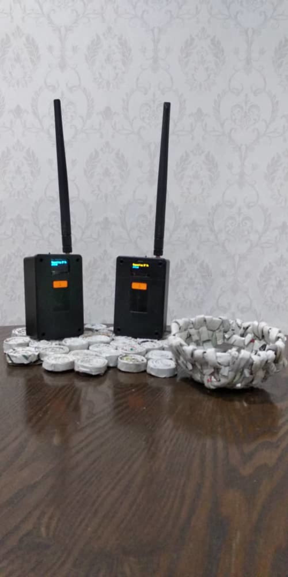
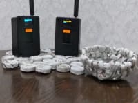
Long Range (LoRa) communication was used to achieve the objectives of this project. A microcontroller receives position data from a Global Positioning System (GPS) receiver using universal asynchronous receiver-transmitter (UART) communication. The data obtained is processed and displayed on the LCD display containing latitude, longitude and current distance information with the control centre to make it easier for the SAR team members to know the current distance and the requirements for placing a repeater if the distance exceeds 8 km. The microcontroller also sends the data to the LoRa chip for transmission to the control centre. The data speed used is only 300 b/s as LoRa can reach longer distances when low data speeds are used. In addition to distance data, the module can also send other statuses selected by the user, such as emergency notifications and logistics status. The use of the frequency of 433 MHz for the beacon's transmissions has been approved by the Malaysian Communications & Multimedia Commission (MCMC).
This module uses rechargeable battery power. Three 18650 batteries are used, which can last up to 20 hours. In order to facilitate the integration between the components, a printed circuit board (PCB) circuit was developed to ensure that the connection between the components is more systematic and easy to maintain.
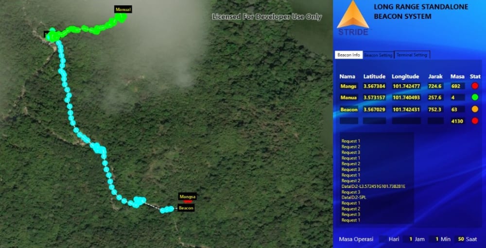
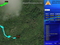
For the map view system at the control centre terminal, ESRI ArcGIS was chosen as the mapping engine because it is capable of displaying maps offline. This display was developed for the Windows platform using Visual Studio 2019 Windows Presentation Foundation (WPF). For the control centre, a terminal, containing a computer with the mapping program, LoRa transceiver and LED TV display, is used to provide a live view of each data transmitted by the module supplied to each SAR team member. The program developed includes functions such as displaying latitude and longitude, distance, transmission status, point of each position on a map, custom map function, and emergency status.
Video
Like this entry?
-
About the Entrant
- Name:Dinesh Sathyamoorthy
- Type of entry:teamTeam members:Shaiful Bahri Zainal Abidin
Hanafiah Hussein
Kamil Hamadan
Dinesh Sathyamoorthy
Noorliza Hamdan
Abdul Halim Jusoh
Ahmad Firdaus Ahmad Kazmar
Nor Munawirah Fadaah Ab Rahman
Zaherudin Zaimy
Mohd Zuryn Mohd Daud
Hasrul Said Abdul Khatab
Rosdi Shafie
Shamsuziran Ismail
Harashid Rusli
Ankashah Ishak
Fauzi Wahab
Fadhly Amin Yusof
Mahadi Berahim
Mohd Adnan Firdaus Abd. Jamil - Software used for this entry:Visual Studio 2019
- Patent status:pending