The rise of human activity since the beginning of the 20th century, due to rapid rise in industrialization, made it necessary to create marketing and transport facilities. Further, heavy laden vehicles on roads have put pressure on it. The asphalt paving industry is constantly exploring technological improvements that will enhance the material’s performance, increase construction efficiency, conserve resources, and advance environmental stewardship.
To get required strength of roads various materials were altered, amongst them bitumen is a better option than tar but not the best one, as eventually by using the bitumen too, various health problems and pollution problems are caused.
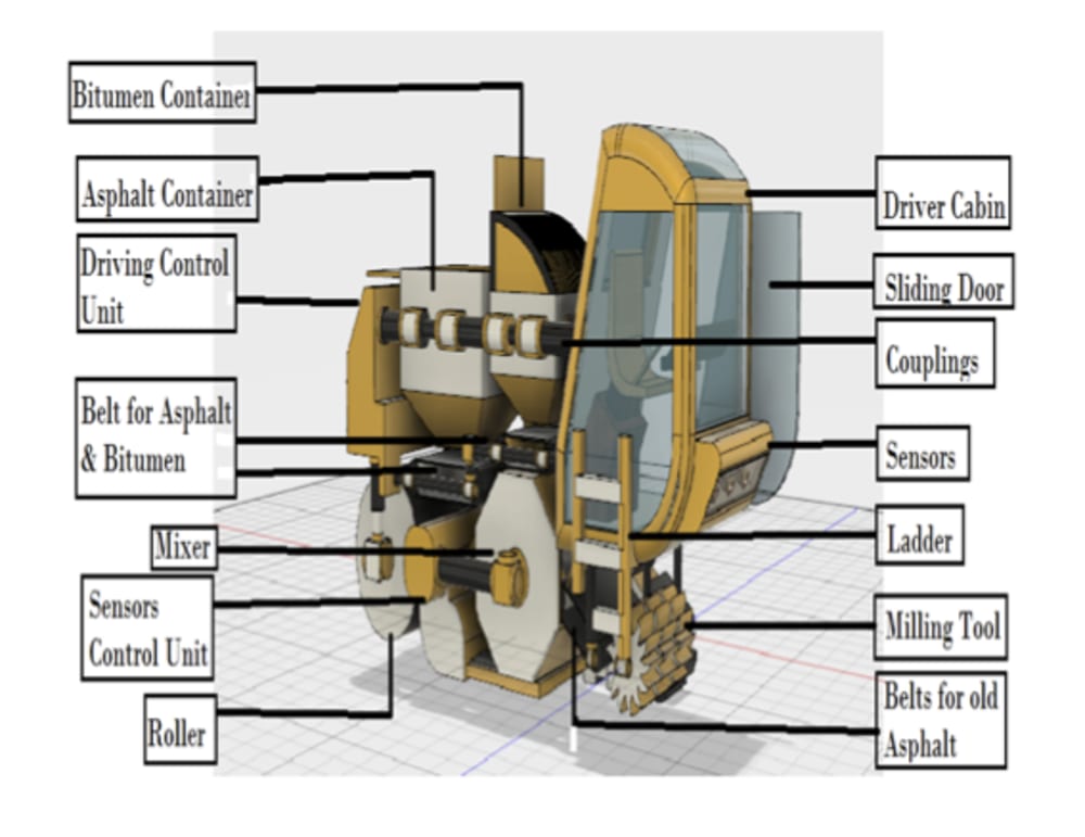
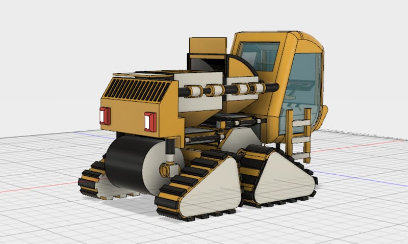
So instead of just keeping on changing the material we are using to avoid the problems, we can change the technology we are using along with the material. By saying this I further suggest the idea of a machine which can be implemented for road construction, I call it 'LIDAR Road Paver.' It is the new generation technology which make use of LIDAR sensors for mapping of uneven road profile. There is a milling tool at the front of the paver to remove the previously layer asphalt for reuse. The removed material is transferred to the mixing container using moving belt. The height of milling tool can be adjusted according to the requirement. Also there are containers attached to the paver containing fine crushed stones and a container having bitumen in it. There is heater to keep the bitumen in melted state which is necessary for paving. There are height sensors at the top end of the containers which are helpful in precisely measuring the flow of material out of these containers. These outflow material is released in a mixing container using rotating belts. Now here in mixer, the whole thing is properly churned together to make it one proper unit for paving. The most important process starts further. The LIDAR sensors have scanned the road surface and a computerized map is created this data is given to the gates at the base of the machine to precisely control the outflow of material.
If we are able to control the outflow precisely, the constructed roads will be uniform with no bumps nor any depressions on them. If there are no defects in the road profile there will be less erosion of the bitumen. The constructed roads will last longer and better.
Concluding Remarks
• By using the LIDAR Road Paver we can make proper use of the petroleum product 'bitumen' without wastage so ultimately helpful for the economy of the nation.
• It can be helpful to avoid the direct contact of the human beings with the carcinogenic bitumen, so improving public health.
• Also the release of fumes during the work can be well treated and controlled to avoid pollution by all possible way, so ecofriendly too.
• Also the proportion of mixing of crushed stones or asphalt and bitumen can be well controlled, thus precisely making long-lasting roads.
Like this entry?
-
About the Entrant
- Name:Pratik Gaikwad
- Type of entry:individual
- Software used for this entry:Autodesk Fusion 360
- Patent status:none


